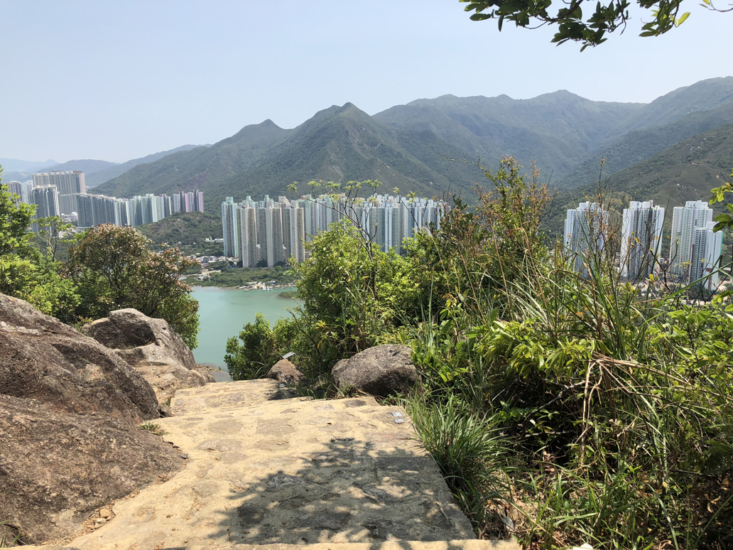
While it should be one of the most popular hiking trails in Hong Kong, very few people seem to know about the Ngong Ping 360 Rescue Trail – a 6-kilometer trail (but feels like 8 kilometers) running directly under the cable cars in Lantau Island Hong Kong leading to the Big Buddha. The trail is called that because the commercial park you travel to before getting to the monastery and the Big Buddha is called Ngong Ping 360, and the trail was originally built to service the cable cars throughout the whole trail, breaking from the trail for only less than a kilometer.
Before you get to the hiking trail, you first have to find it, and this is tricky by itself. To save everyone the possible routes from ether Kowloon or the Hong Kong side of the island, I’ll begin the guide from Citygate Mall – the famous discount mall in Lantau Island and where you can find the starting point for the cable cars.
From Citygate Mall, head to Tat Tung Road. If you’re looking at the cable car entrance, it should be to your left. Make a right at Tat Tung Road and head all the way to the end which takes you to Shun Tung Rd. Make a left and head all the way to Yu Tung Rd where you will make a right. Follow Yu Tung Road all the way down until you see an over road bridgeway. Stay under the bridgeway. You’ll see a path on the right slightly overlooking the water. Follow the path. Incidentally, the path is called the “Ancient Trail.”
Keep following the path until three things are true:
- You passed a toilet with a Playground nearby
- The cable cars are overhead
- And you see the entrance of the trail marked by a silver marker labeled “C 00” with the icon of a hiker above the C00 marker
The hike begins…
MAKE SURE YOU BROUGHT A HIKING STAFF! You’ll regret it if you start this trail without a pair. The trail is easily 3 to 4 hours of hiking – for a fairly fit individual (I hit the gym for 2 hours 4 to 6 times a week with each day having over 10K steps).
This is where it is VERY IMPORTANT to pace yourself. C00 to C02 is almost exclusively an upward hike of what I estimate to be over 60 floors straight up. The trail becomes slightly easier past C 06, but be prepared for an upward climb until you get to the first cable car tower. But stop whenever you need to. I found myself needing to stop at least every 20 floors taking a 5 to 10 minutes rest to bring my heart rate down (Thanks Fitbit!!) before continuing. The hike is the most time consuming here. A third of the time you spend on the trail will be C00 to C06. The rest will be a good slow and steady upward pace broken by even ground every hundred or so meters.
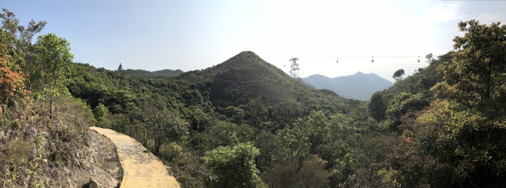

Don’t rush past C15. You’re going to encounter a barrier that says “Warning: Steep Trail Ahead.” It’s a beautiful wooden stairway down and up a ravine between the mountains. Don’t rush this. Take your time to take it all in then move on. If you’re going to enjoy the Rescue Trail, it will be specified by NOT rushing.
The pace past C16 will remain to be easy and steady. Just pace yourself – it’s not a race. Hopefully, you brought some sustenance because this is the part where you start to get hungry and the commercial area of Ngong Ping Park is still an easy 1 hour away.
The hike ends
After a 4 hour hike, you’ll feel accomplished and utterly wasted. Take the time to change in the generously spacious Comfort Rooms of Ngong Ping before heading out and back “home.” There are 2 ways to get back to Citygate and subsequently your hotel (or spa if you really need it at this point) from here. You can take the scenic view by taking the cable car one way back to Citygate. Or, there are busses outside NgongPing 360 that take you back to Citygate. Because there was no line on the bus, I opted for the bus. The ride is about 45 mins. I slept the whole way. Then I took the Tung Chung Line back to Central and back to the hotel.
For a visual guide to the finding the trail, you can find the video I made for my Mom here:
For a time-lapse guide of the actual trail, you can also find the video I made for my Mom here: